Ponta de São Lourenço – Hiking the easternmost point of Madeira
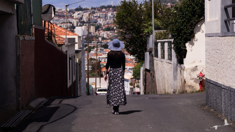
If you plan on visiting the island of Madeira, then you probably have already heard of the numerous hiking trails on this beautiful island. One of these Hiking Trails is PR8 or also called Ponta de São Lourenço Hiking Trail, a Trail positioned on the easternmost part of the island giving an amazing view over the ocean as well as some, for Madeira unusual, landscape.
In this quick guide we will tell you everything we can about the hike itself as well as some information around. So
let´s get started.
Ponta de São Lourenço – Hiking the easternmost point of Madeira.
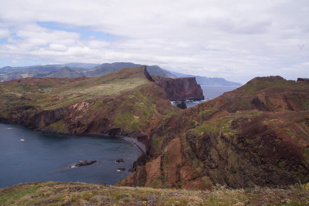
Ponta de São Lourenço is a headland in the east of Madeira and contains the easternmost point of the island. The headland was named after one of Madeiras discoverers’ ships. Nature-wise Ponta de São Lourenço is different from the rest of the island as it is mostly covered by grassland.
In 1982 it was classified as a nature reserve and is also recognized as an Important Bird Area. This variety in landscape makes the Ponta de São Lourenço Hiking Trail all the more interesting and unique compared to other hikes on Madeira.
You want to do more hikes on Madeira? Then, check out:
How do I get there?
The starting point of this hike is very straight forward, since there is basically just one road leading up to the trail and the parking lot is at the end of it. The parking lot is pretty big and even offers parking for busses or RVs. However this hike is rather popular and the parking is free of charge so in high season it is advised to head here early.
Is there an entry fee for the Ponta de São Lourenço hike?
Yes, as of January 2025 they introduced an entry fee on various Hiking Trails to help maintain the environment. The fee is 3 euro per person for any non-resident over 12 years old. Children under the age of 12 are always free. Hikers who are caught hiking without having paid the fee will have to pay a fine of around 50 euros.
Payment must, at the moment be made over Simplifica Madeira Website (February 2025). We will update this as soon as we hear of any other methods to pay either online or directly at the trail.

How long is the hike?
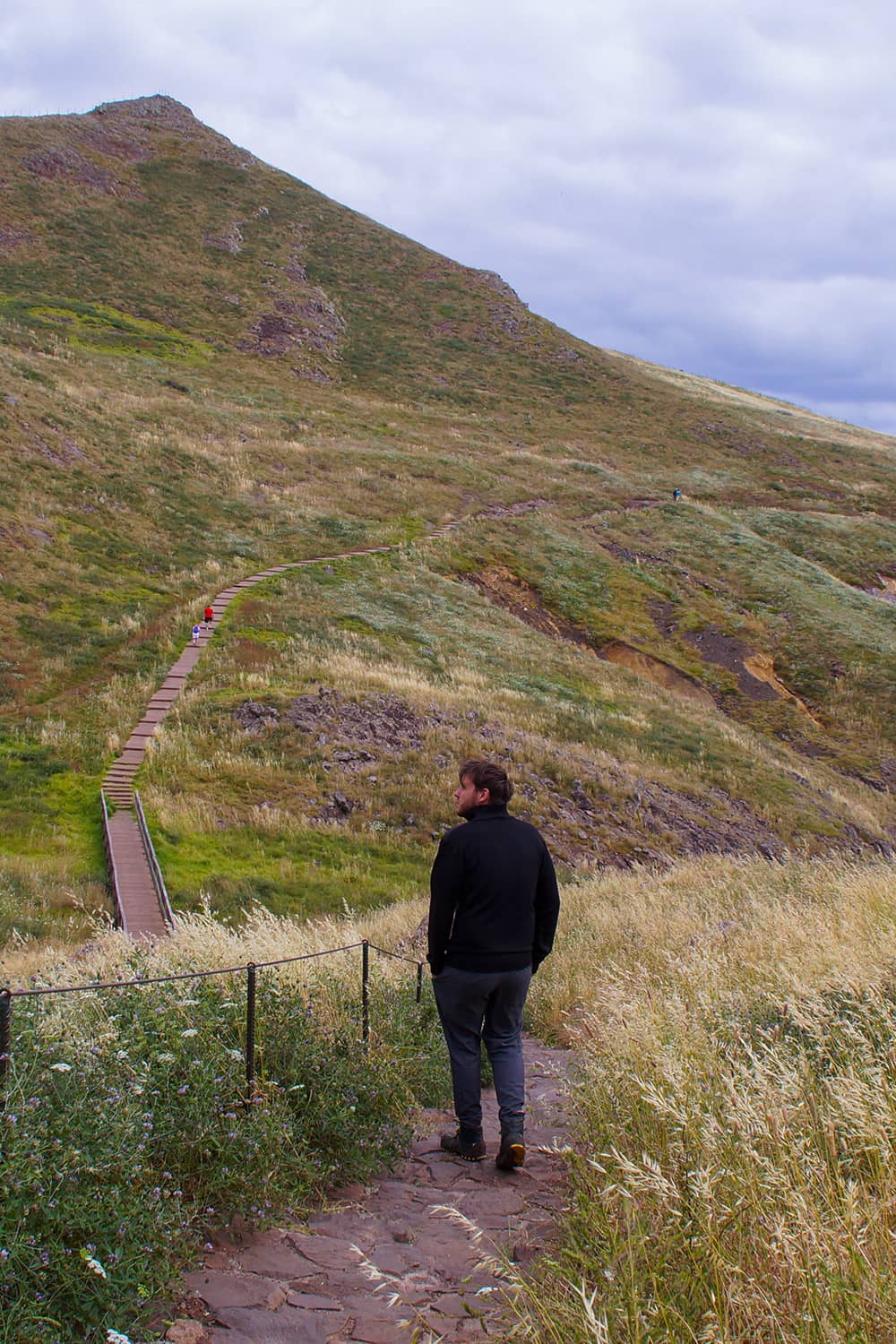
The Ponta de São Lourenço Hiking Trail is a one-way hiking trail towards Pico do Furado, one of the highest points of this headland. The hike from the starting point towards Pico do Furado is a little over 3km long. Since this hike is a one-way hike, you will have to hike the same route back (which leads to around 6-7km).
Is it a difficult hike?
The hike only has a 100m altitude difference (lowest point compared to highest point), however the trail itself constantly changes between going up and down which means that you will actually have to walk a lot more altitude difference. The hardest part is the last stretch towards Pico do Furado which is pretty steep.
We would however say that everyone can do this hike and would classify it as easy to medium difficulty hike depending on your fitness level.
Ponta de Sao Lourenco Trail Summary
- Distance: 3 to 3.5 kilometers (one-way) so 6-7 in total
- Elevation Gain: 100 meters but several times up and down.
- Difficulty: Easy to Medium (depending on fitness level).
- Need a Reservation?: No, but you need to pay in advance.

The path summarised
From the parking lot, the trail starts by descending onto a beautiful grassland. There you can already spot several huge seagulls on the edge of the cliffs behind the grassland, watching over the fish farm that is located on the south side of the headland.
If you are luckier than we were, you might catch a glimpse of the Mediterranean Monk Seal which made this stretch of land their home.
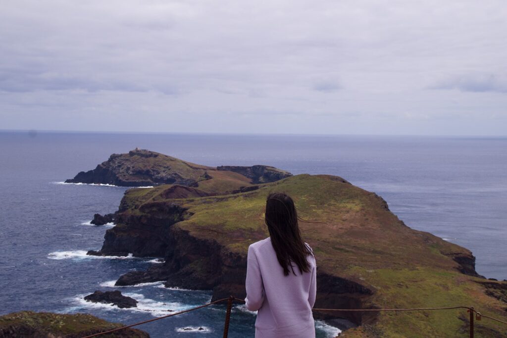
The north side of Ponta de São Lourenço has a rougher coast, with steep cliffs and sharp rocks piercing the sea. The beautiful black and red colors of the rocks attest to the volcanic origin of the island.
You follow the trail up and down the rocky headland and through beautiful grasslands towards a small “oasis”. This refuge (Casa do Sardinha) contains a small restaurant where you can stop for lunch.
After lunch comes the last stretch of the hike, which is also the most difficult one: climbing Pico do Furado. The trail goes straight up the hill and is very steep. It is also not very well secured. But once you reach the top you`ll be rewarded with one of the best views yet. There were also a lot of lizards looking for a sunbathing spot. They even climbed us looking for a warm spot, probably because we wore black.
There are two islands located in front of Pico do Furado, Ilhéu da Cevada and Ilhéu do Farol. The second one is home to the oldest lighthouse of Madeira, named Farol da Ponta de São Lourenço which was finished in 1870.
On your way back, you can check out one of the beaches on the cliffsides if you want. If you decide not to, you will follow the same path to head back to the parking lot.
Is the Ponta de São Lorenço Hike worth it?
In our opinion, this hike is definitely worth it. Especially since the landscape on this peninsula of Madeira is so different from the landscape elsewhere on the island! The hike itself is also not that hard. You should be sure-footed. But the hike should be easily manageable if you are moderately fit.